Severe floods in Manipur, driven by shifting monsoons, deforestation, and urban pressures, have devastated communities and ecosystems, exposing critical gaps in disaster preparedness and the urgent need for sustainable climate resilience strategies.
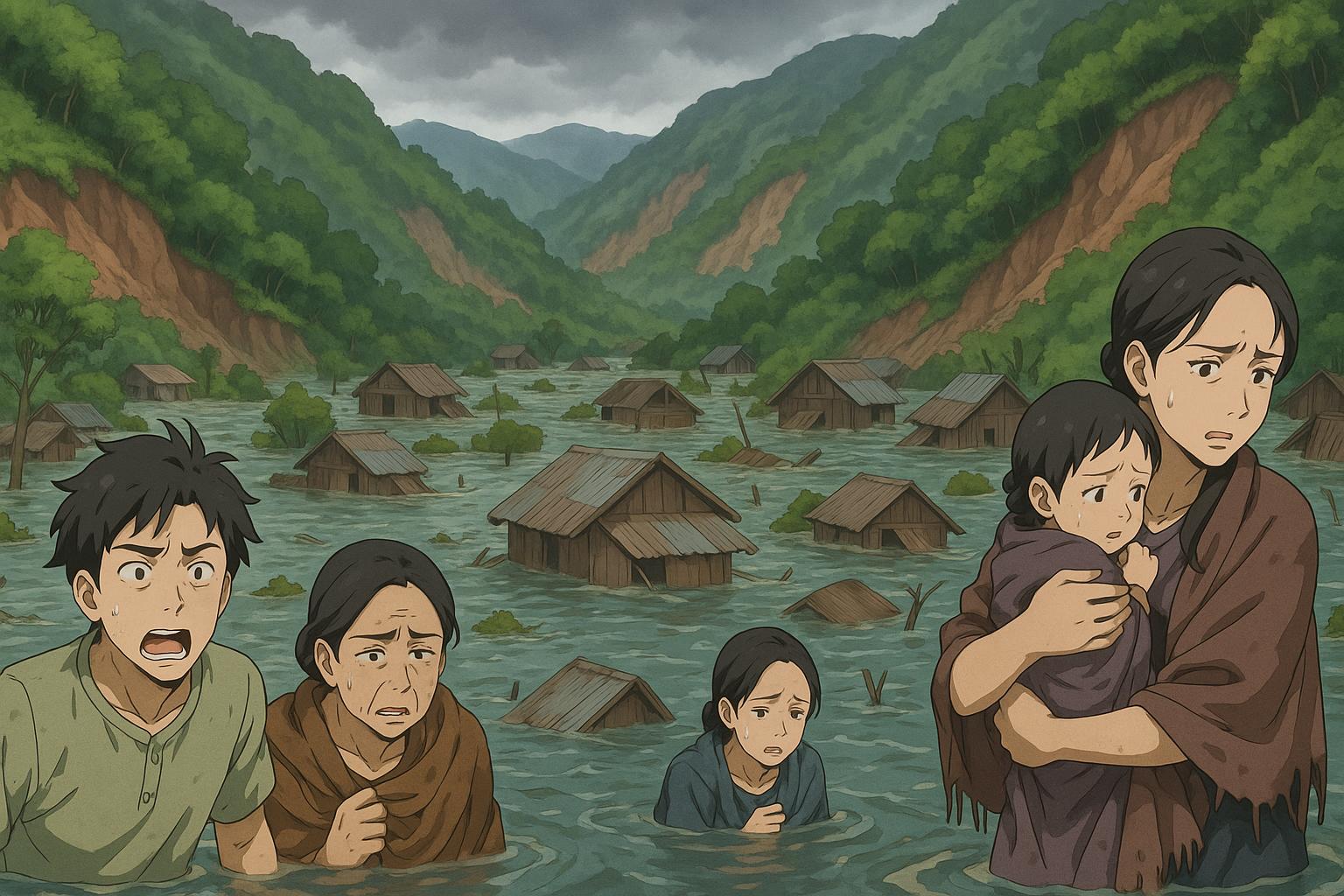
Manipur, nestled in the Eastern Himalayas, has long captivated with its breathtaking landscapes and rich cultural heritage. However, the state is increasingly defined by the devastating floods that have come to plague its communities and ecosystems. The floods of May-June 2025 were particularly severe, affecting over 20,000 people and leading to the destruction of more than 3,000 homes, alongside numerous landslides. This alarming situation serves not only as a stark reminder of nature’s fury but also as a consequence of human-induced ecological neglect and erratic climatic changes.
The gravity of the flooding problem has been corroborated by insights from organisations such as the Indian Meteorological Department (IMD) and the Intergovernmental Panel on Climate Change. These bodies have noted a significant rise in extreme weather events across Northeast India in recent years. Manipur has seen disruptions in its monsoon patterns, characterised by prolonged dry spells followed by intense downpours. Such erratic weather patterns lead to flash floods, particularly in the low-lying Imphal Valley, where poor drainage exacerbates the accumulation of rainwater. This, combined with the region’s geography, results in an influx of runoff that erodes hillsides and deposits silt in river systems, significantly deteriorating their water-carrying capacities.
Drivers of these chronic flooding events include rampant deforestation and shifting agricultural practices, commonly referred to as Thum, where significant portions of forest land are cleared for farming and firewood. In the past, the vegetation played a critical role in soil retention and rainfall absorption. Presently, the denuded hillsides have worsened soil erosion and landslide occurrences, sending unchecked water flow into valleys and rivers that are already struggling to cope with sedimentation. Rivers such as the Iril, Nambul, and Imphal are emblematic of this decline, with their water levels frequently toppling during heavy rainfall.
Urbanisation has compounded these flooding issues. Imphal, the capital, faces challenges from rapid and often unplanned development, leading to the encroachment of wetlands, floodplains, and traditional drainage pathways. These urban adjustments disrupt natural hydrological cycles and create additional pressure on an already overwhelmed drainage infrastructure. Blockages caused by waste accumulation and outdated drainage systems have left residents grappling with stagnant waters after floods, revealing significant oversights in urban planning that have left many areas, like Thangmeiband and Sagolband, at high risk.
Furthermore, the degradation of wetlands, including the vital Loktak Lake — the largest freshwater lake in Northeast India — exacerbates the flooding issue. The lake is increasingly choked by encroachment and pollution, diminishing its regulatory capacity for floodwaters. Floating vegetation and debris act as barriers, leading to the stagnation of water and further complicating flooding. As its ecological health declines, the livelihoods of communities dependent on the lake are also significantly jeopardised, particularly impacting local fishermen.
The socio-economic repercussions of these floods fall hardest on the region’s vulnerable populations, including impoverished households, farmers, and indigenous communities. As standing crops are submerged, many families face the stark reality of food insecurity and income loss, while women and children bear additional burdens of displacement and health risks associated with contaminated water supplies. Flooding becomes a recurrent cycle, deepening the vulnerability of already-marginalised groups and perpetuating a landscape of poverty.
Despite the existence of the Manipur State Disaster Management Authority (MSDMA), there are critical gaps in disaster preparedness and response systems. For instance, coordination between agencies is often poor; citizens have reported delays in receiving aid during crises. The lack of effective early warning systems, especially in rural villages with limited internet access, further hampers efforts to mitigate flood risks. A reactive rather than proactive approach prevails, focusing on immediate relief rather than long-term resiliency building.
To address these multifaceted challenges, Manipur needs to implement comprehensive, evidence-based strategies for flood management and climate resilience. Recommendations include afforestation initiatives, particularly on hillside areas, and the restoration of natural water management systems. Integrated urban drainage plans must be developed to ensure that storm-water systems are equipped to handle extreme weather, with the restoration of ancient water channels and wetlands being a priority.
Moreover, the promotion of climate-resilient agricultural practices would benefit local farmers. Introducing flood-tolerant crop varieties and diversifying farming practices can help buffer against crop failure during floods. Upgrading technology for early warning systems, utilizing predictive analytics, and improving community preparedness through educational initiatives will further fortify Manipur’s resilience to flooding.
Success stories, such as the village of Phayeng, which has been recognised as India’s first carbon-positive village due to its eco-friendly practices, highlight the potential for meaningful community-led restoration. The Imphal Riverfront Development Project, if executed sensitively, could provide both green spaces and enhanced flood protection.
The persistent flooding that has befallen Manipur is neither an unavoidable disaster nor an act of nature alone. Instead, it is the outcome of policy neglect, ecosystem degradation, and inadequate infrastructure planning. Though daunting, the path forward is not beyond reach. Through collective action, sustainable practices, and robust planning, the state can build a future resilient to flooding, protecting both its people and their cherished land for generations to come. The recent disasters must ignite a sense of urgency and commitment to reshaping Manipur’s environmental narrative.
 Reference Map:
- Paragraph 1 – [1], [4]
- Paragraph 2 – [1], [2], [5]
- Paragraph 3 – [3], [6]
- Paragraph 4 – [2], [5], [3]
- Paragraph 5 – [4], [6]
- Paragraph 6 – [4], [7]
- Paragraph 7 – [3], [6]
- Paragraph 8 – [4], [3]
- Paragraph 9 – [7]
- Paragraph 10 – [1], [2]
- Paragraph 11 – [4], [3]
- Paragraph 12 – [5]
Source: Noah Wire Services
- https://e-pao.net/epSubPageExtractor.asp?src=education.Science_and_Technology.Understanding_Manipur_recurring_floods_By_Th_Manimala – Please view link – unable to able to access data
- https://m.sikkimexpress.com/article/flood-in-manipur-hill-and-valley-regions/93756 – This article discusses the causes of flooding in Manipur’s hill and valley regions, highlighting the role of deforestation and urbanization. It explains how the lack of vegetation leads to increased erosion and sediment transport, contributing to flooding and landslides. The piece also addresses the impact of unplanned urban development on natural waterways and wetlands, emphasizing the need for comprehensive flood control policies and disaster management strategies to mitigate these issues.
- https://imphalreviews.in/government-should-remain-prepared-for-disaster-management-and-make-holistic-flood-control-policy/ – This article examines the causes of frequent floods in Manipur, attributing them to factors such as overflowing rivers, improper drainage systems, and the loss of traditional water management practices. It critiques the replacement of traditional drainage systems with modern ones and the abolition of community ponds, which have historically served as water reservoirs. The piece calls for a holistic approach to flood control, integrating traditional knowledge and modern engineering solutions to address the state’s flooding challenges.
- https://imphalreviews.in/need-for-a-comprehensive-approach-to-control-the-impact-of-flood-on-vulnerable-and-marginalized-communities-in-the-state-of-manipur/ – This article highlights the impact of floods on vulnerable and marginalized communities in Manipur, emphasizing the need for a comprehensive approach to disaster management. It discusses the loss of wetlands and other water bodies, deforestation, siltation, and illegal encroachment as major contributing factors to flash floods. The piece advocates for the restoration of traditional water management systems and the integration of community-based approaches to enhance resilience against flooding.
- https://manipur.pscnotes.com/2024/12/24/environmental-issues-of-manipur/ – This article provides an overview of environmental issues in Manipur, focusing on deforestation, climate change, and the degradation of wetlands. It details the causes of deforestation, including shifting cultivation, demand for fuelwood, illegal logging, and infrastructure development. The piece also discusses the impacts of deforestation, such as loss of biodiversity and increased flooding. Additionally, it addresses the degradation of wetlands like Loktak Lake and the need for conservation efforts to protect these vital ecosystems.
- https://www.thesangaiexpress.com/Encyc/2024/6/2/YenningOn-31st-May-2024-Yumnam-Rupachandra-Editor-Impact-TV-posted-on-Facebook-Could-the-flood-impact-on.html – This article examines the impact of urbanization on flooding in Manipur, particularly focusing on the construction of permanent structures along riverbanks. It explains how these structures reduce the capacity of rivers to carry floodwater, leading to intensified flooding in surrounding areas. The piece also discusses the destruction of riparian ecosystems due to urban development and the exacerbation of flooding problems. It calls for sustainable urban planning and the restoration of natural water management systems to mitigate flood risks.
- https://icsf.net/newss/manipur-world-environment-day-our-land-our-future/ – This article discusses the environmental challenges faced by Manipur, including deforestation, wetland degradation, and pollution. It highlights the role of wetlands in carbon sequestration and the alarming decline in the number of lakes in the state. The piece also addresses the impact of pollution from vehicles and the need for immediate restoration of affected areas. It emphasizes the importance of protecting natural resources to combat climate change and ensure the future sustainability of the region.
Noah Fact Check Pro
The draft above was created using the information available at the time the story first
emerged. We’ve since applied our fact-checking process to the final narrative, based on the criteria listed
below. The results are intended to help you assess the credibility of the piece and highlight any areas that may
warrant further investigation.
Freshness check
Score:
8
Notes:
The narrative discusses the severe floods in Manipur during May-June 2025, affecting over 20,000 people and damaging more than 3,000 homes. Similar events occurred in May 2024, with reports indicating over 1.88 lakh people affected and more than 24,000 houses damaged. ([thehindu.com](https://www.thehindu.com/news/national/manipur/manipur-govt-to-provide-10000-to-every-flood-affected-family/article68288513.ece?utm_source=openai)) The 2025 report includes updated data, suggesting a higher freshness score, but the recurring nature of the floods may indicate recycled content.
Quotes check
Score:
7
Notes:
The narrative references insights from the Indian Meteorological Department (IMD) and the Intergovernmental Panel on Climate Change (IPCC). While these organisations have reported on similar flooding events in the past, specific quotes from these bodies are not provided in the available sources. The absence of direct quotes may indicate original reporting, but the lack of verifiable sources raises questions about the authenticity of the claims.
Source reliability
Score:
6
Notes:
The narrative originates from e-pao.net, a regional news outlet. While it provides detailed coverage of local events, its credibility is not widely established. The absence of verifiable sources and the lack of direct quotes from reputable organisations like the IMD and IPCC raise concerns about the reliability of the information presented.
Plausability check
Score:
7
Notes:
The narrative describes severe flooding in Manipur during May-June 2025, with over 20,000 people affected and more than 3,000 homes damaged. Similar events occurred in May 2024, with reports indicating over 1.88 lakh people affected and more than 24,000 houses damaged. ([thehindu.com](https://www.thehindu.com/news/national/manipur/manipur-govt-to-provide-10000-to-every-flood-affected-family/article68288513.ece?utm_source=openai)) The consistency of these events over consecutive years suggests a plausible scenario. However, the lack of specific details and verifiable sources in the 2025 report raises questions about its authenticity. The absence of direct quotes from reputable organisations like the IMD and IPCC further diminishes the plausibility of the claims.
Overall assessment
Verdict (FAIL, OPEN, PASS): FAIL
Confidence (LOW, MEDIUM, HIGH): MEDIUM
Summary:
The narrative presents a plausible account of severe flooding in Manipur during May-June 2025, with over 20,000 people affected and more than 3,000 homes damaged. However, the lack of direct quotes from reputable organisations like the IMD and IPCC, combined with the absence of verifiable sources, raises significant concerns about the authenticity and reliability of the information presented. The similarities to previous events in May 2024, where over 1.88 lakh people were affected and more than 24,000 houses damaged, ([thehindu.com](https://www.thehindu.com/news/national/manipur/manipur-govt-to-provide-10000-to-every-flood-affected-family/article68288513.ece?utm_source=openai)) suggest that the content may be recycled or based on unverified reports. Given these factors, the narrative fails to meet the standards of a credible news report.