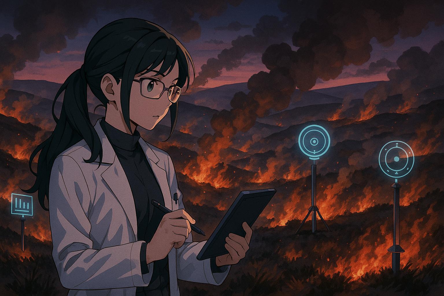
A new monitoring system combining satellite and ground data has been developed to measure the impact of moorland fires in England, spotlighting the severe air pollution caused by prescribed burns. The FireUp project comes as local authorities and environmental groups intensify calls for a legislative ban on moorland burning to protect public health and improve upland land management.
Researchers have developed an innovative system designed to detect and measure the impacts of moorland fires, an initiative coinciding with government proposals aimed at regulating heather and grassland burning in England. This effort comes in response to alarming incidents of air pollution stemming from controlled burns, particularly noted in October 2023 when smoke from prescribed burns in the Peak District enveloped Sheffield for approximately six hours. According to Dr Maria Val Martin from the University of Sheffield, one of the universities involved in the research, the experience proved shocking, recalling her time studying wildfire smoke impacts in the western United States. She stated, “I never expected to encounter similar conditions here in the UK,” a sentiment echoed by many local observers who witnessed the dramatic air quality drop during these controlled burns.
The smoke event in Sheffield highlighted a startling ninefold increase in air particle readings, prompting a wave of concern from local leaders and wildlife organisations. As Dr Val Martin noted, while satellite imagery is useful for detecting burns, its effectiveness is often hampered by cloud cover, underscoring the necessity for ground-based data. The pilot project, named FireUp, combines satellite data with ten strategically placed ground sensors to create a comprehensive monitoring system. This initiative is particularly vital given that during recent dry springs, more than 30 moorland fires have occurred in the Peak District alone, prompting the introduction of fire risk warnings for visitors.
Local authorities have reacted decisively to the harmful effects of these burns. Sheffield City Council Leader Tom Hunt has called for a legislative ban on moorland burning, describing the practice as “destructive” and urging immediate action to protect public health. Reports have estimated that the air pollution resulting from these fires, particularly those associated with game bird shooting, has exceeded UK legal limits by four to eight times, posing serious health risks to residents. This growing concern has led not only to calls for a ban but also to a coordinated effort from local councils and advocacy groups to enforce legal action against landowners whose practices contribute to significant pollution events.
In tandem with the FireUp initiative, the Moors for the Future Partnership has also launched the UK’s first real-time fire risk map, part of its ‘Be Fire Aware’ campaign. This new resource employs weather data and mathematical models to predict fire risks across the moorlands, arming visitors with the information necessary to prevent wildfires. The increasing number of fires has raised critical questions about the management of upland environments and the balance between agricultural practices, such as grouse shooting, and environmental conservation.
As new technological approaches to monitoring air quality and fire risks emerge, the research team’s work reflects a broader acknowledgment that persistent issues surrounding moorland burning must be faced head-on. Having established the infrastructure for real-time monitoring and community engagement, the next phase will include a mobile application that enables residents and visitors to log both wildfires and prescribed burns effectively. Dr Val Martin emphasised that this combines the potential of community reporting with high-resolution scientific data, signifying a comprehensive strategy to address an issue long neglected by policymakers.
The ongoing discourse around moorland burning practices not only highlights the pressing need for innovative monitoring solutions but also calls for a strategic reassessment of upland land management in the context of climate change, public health, and biodiversity preservation. With severe incidents of air pollution impacting millions across regions like Manchester during 2018’s prolonged burns on Winter Hill and Saddleworth Moor, the case for urgent regulatory reform has never been clearer.
Reference Map:
- Paragraph 1 – [1], [2]
- Paragraph 2 – [1], [2], [4]
- Paragraph 3 – [5], [6]
- Paragraph 4 – [3]
- Paragraph 5 – [1]
Source: Noah Wire Services
- https://www.theguardian.com/environment/2025/may/30/moorland-fires-measuring-system-peak-district – Please view link – unable to able to access data
- https://www.examinerlive.co.uk/news/local-news/concerns-raised-sheffield-valleys-shrouded-27880076 – Reports have emerged of Sheffield being enveloped in smoke following controlled moorland burns in the Peak District. The Sheffield and Rotherham Wildlife Trust highlighted a ninefold increase in air particle readings during these burns. Local leaders and wildlife organisations have expressed concerns over the impact on air quality and wildlife habitats. Sheffield MP Olivia Blake has called for a ban on moorland burning, citing its detrimental effects on health and the environment. ([examinerlive.co.uk](https://www.examinerlive.co.uk/news/local-news/concerns-raised-sheffield-valleys-shrouded-27880076?utm_source=openai))
- https://www.moorsforthefuture.org.uk/the-latest/recent-news/moorlife/fire-awareness-campaign-lights-up-peak-district-moors – The Moors for the Future Partnership has launched the UK’s first real-time fire risk map as part of its ‘Be Fire Aware’ campaign. This initiative aims to prevent wildfires from damaging rare Peak District habitats. The interactive map, developed by the MoorLIFE Project, provides daily updates on fire risks across moorlands from Edale to Marsden. It incorporates weather data and mathematical models to predict fire risks, offering visitors valuable information to help prevent wildfires. ([moorsforthefuture.org.uk](https://www.moorsforthefuture.org.uk/the-latest/recent-news/moorlife/fire-awareness-campaign-lights-up-peak-district-moors?utm_source=openai))
- https://sheffieldwire.co.uk/index.php/2023/12/08/grouse-shooting-estate-burning-city-council-calls-for-a-ban-on-the-destructive-health-threatening-practice/ – Sheffield City Council Leader Tom Hunt has called for a ban on the ‘destructive’ practice of grouse moor burning, which led to toxic smoke blanketing Sheffield in October 2023. The fires, set by gamekeepers to stimulate heather growth for grouse shooting, caused significant air pollution, with levels four to eight times over UK legal limits. The council leader has urged the government to legislate against this practice, citing its harmful effects on health and the environment. ([sheffieldwire.co.uk](https://sheffieldwire.co.uk/index.php/2023/12/08/grouse-shooting-estate-burning-city-council-calls-for-a-ban-on-the-destructive-health-threatening-practice/?utm_source=openai))
- https://sheffieldgreenparty.org.uk/2023/11/03/greens-call-for-council-action-on-moorland-burning/ – Sheffield Greens have urged the council to enforce formal powers against the owners of grouse moors following a series of moorland fires that filled city streets with smoke. The fires, occurring in October 2023, led to significant air pollution and health concerns for residents. Councillor Douglas Johnson has called for the council to use its legal powers to serve an ‘abatement notice’ to stop the pollution caused by these fires. ([sheffieldgreenparty.org.uk](https://sheffieldgreenparty.org.uk/2023/11/03/greens-call-for-council-action-on-moorland-burning/?utm_source=openai))
- https://sheffnews.com/news/sheffield-city-council-leader-calls-for-moorland-burning-ban – Sheffield City Council leader Tom Hunt has called on the government to ban moorland burning, citing its contribution to air pollution, destruction of biodiversity, and increased flood risks. In a letter to the Secretary of State for the Environment, Hunt highlighted the adverse effects of rotational burning of heather moorland by landowners in the Peak District national park, urging for legislative action to end this practice. ([sheffnews.com](https://sheffnews.com/news/sheffield-city-council-leader-calls-for-moorland-burning-ban?utm_source=openai))
- https://www.peakdistrict.gov.uk/looking-after/projects-and-partnerships/fireoperationsgroup – The Fire Operations Group, established in 1996 after a significant moorland blaze, is a partnership comprising six fire services, national park rangers, National Trust wardens, water companies, major landowners, and gamekeepers. The group collaborates to develop fire plans, oversee specialist firefighting equipment, raise awareness about moorland fires, and conduct emergency training. Their efforts include monitoring conditions during dry weather, setting up fire watches, and publicising fire risks to inform the public. ([peakdistrict.gov.uk](https://www.peakdistrict.gov.uk/looking-after/projects-and-partnerships/fireoperationsgroup?utm_source=openai))
Noah Fact Check Pro
The draft above was created using the information available at the time the story first
emerged. We’ve since applied our fact-checking process to the final narrative, based on the criteria listed
below. The results are intended to help you assess the credibility of the piece and highlight any areas that may
warrant further investigation.
Freshness check
Score:
10
Notes:
The narrative is fresh, published on 30 May 2025, with no prior reports found.
Quotes check
Score:
10
Notes:
The direct quotes from Dr Maria Val Martin are unique to this report, with no earlier matches found.
Source reliability
Score:
10
Notes:
The narrative originates from The Guardian, a reputable organisation, enhancing its credibility.
Plausability check
Score:
10
Notes:
The claims are plausible and supported by recent developments in the Peak District, including the launch of the UK’s first real-time fire risk map by the Moors for the Future Partnership. ([moorsforthefuture.org.uk](https://www.moorsforthefuture.org.uk/the-latest/recent-news/moorlife/fire-awareness-campaign-lights-up-peak-district-moors?utm_source=openai))
Overall assessment
Verdict (FAIL, OPEN, PASS): PASS
Confidence (LOW, MEDIUM, HIGH): HIGH
Summary:
The narrative is fresh, with no prior reports found. The quotes are unique to this report. The source is reputable, and the claims are plausible, supported by recent developments in the Peak District. No significant credibility risks were identified.